It’s no secret that our winter snowpack was less than stellar.
In many parts of the Cascades, the snowpack peaked at only around 50% to 60% of normal levels by the middle of March.
So what do you say we add a bit more to those tallies in the middle of May?
After a warm start to the workweek with a record-tying 82 degrees at SeaTac on Tuesday, a much colder air mass has settled into the Pacific Northwest.
Showers continue to rotate through the region, and the higher ski terrain was already picking up rounds of snow on Wednesday and Thursday.
However, the coolest part of this chilly change is still to come.
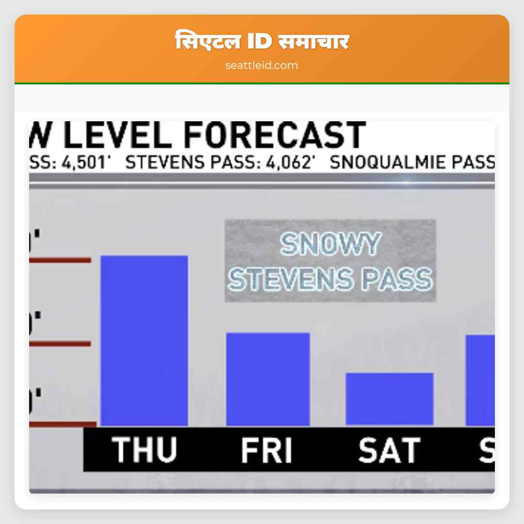
A deepening pocket of low pressure will dig into Washington on Friday and Saturday, dragging the snow level down to 3,500 feet. Friday morning, we were already seeing snowflakes falling and coating the leaves and grasses by the road at Stevens Pass, and light accumulations had collected on some of the ski terrain.
Rounds of rain will race through the lowlands from Seabrook to Seattle, but up in the Cascades, the precipitation will lean into the frozen variety. The snow level will continue to drop on Friday evening, falling again around Stevens Pass Friday night, with some accumulations by Saturday morning.
Cascade crossers over Blewett, White, and Stevens passes will need to prepare for periods of wintry driving conditions as we head into the weekend. Some of the heavier showers will include hail or lightning, especially on Saturday.
By the time the precipitation is wrapping up mid-weekend, the ski areas will have picked up a fresh 4 to 10 inches of snow, with the highest amounts near Mt. Baker.Then skies will settle down, and we’ll warm back up to more typical temperatures in the low 60s by Sunday.
ट्विटर पर साझा करें: Pass travelers to encounter wintry driving in the Cascades this weekend